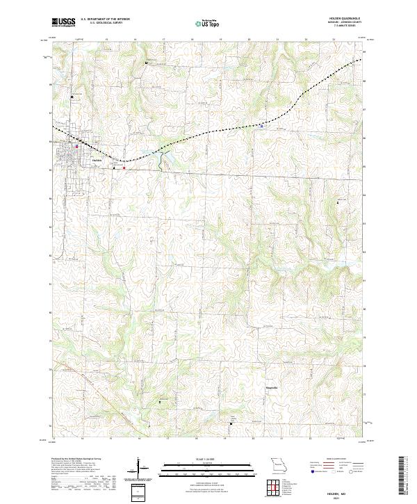
2021 Map of Holden
USGS Topo · Published 2021About this map
Holden serves as the primary municipal center in this western Johnson County landscape, organized by a rigid grid of local routes like SW 1251st Rd and SW 1001st Rd. The town's street plan is clearly delineated, featuring a concentrated residential and commercial core surrounding W Chestnut St and E 10th St. To the south, the small community of Magnolia marks a secondary point of settlement amidst a network of drainage creeks.
Find a feature on this map
79 named features on this map. Tap any name to fly to it.
Don’t see what you’re looking for? This feature index may not catch every label — zoom into the map to look around manually.
Map Details
Editions of this 2021 Holden Map
This is the sole edition of this map. No revisions or reprints were ever made.
Other maps of this area

1885 · Warrensburg
USGS Topo · 1:125,000

1887 · Harrisonville
USGS Topo · 1:125,000

1887 · Warrensburg
USGS Topo · 1:125,000

1892 · Harrisonville
USGS Topo · 1:125,000

1894 · Harrisonville
USGS Topo · 1:125,000

1894 · Warrensburg
USGS Topo · 1:125,000

1947 · Jefferson City
USGS Topo · 1:250,000

1947 · Lawrence
USGS Topo · 1:250,000

1950 · Lawrence
USGS Topo · 1:250,000

1954 · Jefferson City
USGS Topo · 1:250,000