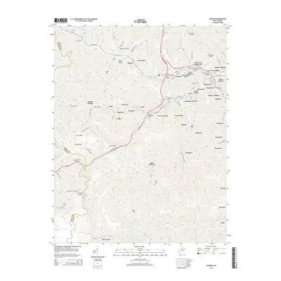
2014 Map of Holden
USGS Topo · Published 2014About this map
Troy Town and Verdunville anchor the northern landscape of this Logan County survey, where the winding waters of Mud Fork flow through the narrow valleys typical of the West Virginia coalfields. The map documents a dense network of mountain communities such as Holden, Monaville, and Omar, many of which developed around the industrial demands of the local mining and rail economy. Steep ridgelines separate these hollows, punctuated by landmarks like the Pickering Knob Lookout Tower and the Railroad Tunnel Overpass near Trace Fork.
Find a feature on this map
129 named features on this map. Tap any name to fly to it.
Don’t see what you’re looking for? This feature index may not catch every label — zoom into the map to look around manually.
Map Details
Editions of this 2014 Holden Map
This is the sole edition of this map. No revisions or reprints were ever made.
Other maps of this area

1887 · Warfield
USGS Topo · 1:125,000

1891 · Oceana
USGS Topo · 1:125,000

1891 · Warfield
USGS Topo · 1:125,000

1893 · Oceana
USGS Topo · 1:125,000

1898 · Oceana
USGS Topo · 1:125,000

1909 · Matewan
USGS Topo · 1:48,000

1909 · Gilbert
USGS Topo · 1:48,000

1910 · Holden
USGS Topo · 1:48,000

1912 · Gilbert
USGS Topo · 1:62,500

1912 · Holden
USGS Topo · 1:62,500