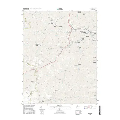
2016 Map of Holden
USGS Topo · Published 2016About this map
The mountain valleys of Holden and Verdunville define this 2016 survey, where the rugged Coal River and Guyandotte River watersheds are marked by a dense network of residential additions and unincorporated communities. The landscape is a complex mix of narrow valley floors and high ridges like Cabin Hill and Pickering Knob, with the local geography heavily influenced by the region's industrial footprint, evidenced by the Islandcreek Mine Rd and Island Creek. Numerous family cemeteries such as Avis Cem, Baisden Cem, and Mounts Cem are preserved on the hillsides above the settlements of Black Bottom and Thompson Town. Modern infrastructure, including the Railroad Tunnel Overpass and the Sergeant Ted Belcher Bridge, navigates the steep elevation changes. The map reveals how the narrow drainages of Mud Fork and Whitman Cr have concentrated local development into distinct clusters like Whitman Junction and Hedgeview.
Find a feature on this map
122 named features on this map. Tap any name to fly to it.
Don’t see what you’re looking for? This feature index may not catch every label — zoom into the map to look around manually.
Map Details
Editions of this 2016 Holden Map
This is the sole edition of this map. No revisions or reprints were ever made.
Other maps of this area

1887 · Warfield
USGS Topo · 1:125,000

1891 · Oceana
USGS Topo · 1:125,000

1891 · Warfield
USGS Topo · 1:125,000

1893 · Oceana
USGS Topo · 1:125,000

1898 · Oceana
USGS Topo · 1:125,000

1909 · Matewan
USGS Topo · 1:48,000

1909 · Gilbert
USGS Topo · 1:48,000

1910 · Holden
USGS Topo · 1:48,000

1912 · Gilbert
USGS Topo · 1:62,500

1912 · Holden
USGS Topo · 1:62,500