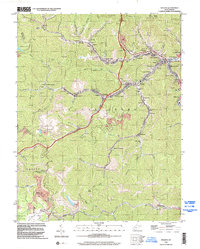
1996 Map of Holden
USGS Topo · Published 2002About this map
Holden and the surrounding hollows of Logan County define this coal-country landscape in the late 1990s. The region's industrial character is clear through the extensive Mine railroads and numerous Strip Mine sites that weave through the ridges. Communities like Whitman, Shamrock, and Verdunville are tightly packed along the narrow valley floors of Island Creek and Mud Fk. This survey serves as a vital record for genealogists, documenting family landmarks such as the Farrar Cem, Baisden Cem, and Mounts Cem. Notable local landmarks include the Whitman Sch and the Coal Miners Chapel, which reflect the social fabric of these mining towns. To the north, the protected lands of Chief Logan State Park offer a contrast to the heavily worked terrain of the southern coal branches near Omar.
Find a feature on this map
87 named features on this map. Tap any name to fly to it.
Don’t see what you’re looking for? This feature index may not catch every label — zoom into the map to look around manually.
Map Details
Editions of this 1996 Holden Map
This is the sole edition of this map. No revisions or reprints were ever made.
Other maps of this area

1887 · Warfield
USGS Topo · 1:125,000

1891 · Oceana
USGS Topo · 1:125,000

1891 · Warfield
USGS Topo · 1:125,000

1893 · Oceana
USGS Topo · 1:125,000

1898 · Oceana
USGS Topo · 1:125,000

1909 · Matewan
USGS Topo · 1:48,000

1909 · Gilbert
USGS Topo · 1:48,000

1910 · Holden
USGS Topo · 1:48,000

1912 · Gilbert
USGS Topo · 1:62,500

1912 · Holden
USGS Topo · 1:62,500