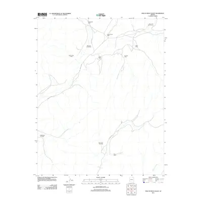
2011 Map of Hole In Rock Valley
USGS Topo · Published 2011About this map
Kitsillie Chapter House serves as a central landmark in this high-desert region of the Chinle Agency, situated near the intersection of several tribal routes. The landscape is defined by a series of distinct drainages and depressions, including the broad Hole in Rock Valley and the evocatively named Pain in the Back Canyon. The drainage network is dominated by the West Fork Oraibi Wash, which is joined by tributaries like Celebration Wash and Aspen Grove Wash.
Find a feature on this map
15 named features on this map. Tap any name to fly to it.
Don’t see what you’re looking for? This feature index may not catch every label — zoom into the map to look around manually.
Map Details
Editions of this 2011 Hole In Rock Valley Map
This is the sole edition of this map. No revisions or reprints were ever made.
Other maps of this area

1883 · Marsh Pass
USGS Topo · 1:250,000

1892 · Marsh Pass
USGS Topo · 1:250,000

1892 · Canyon De Chelly
USGS Topo · 1:250,000

1954 · Shiprock
USGS Topo · 1:250,000

1956 · Marble Canyon
USGS Topo · 1:250,000

1958 · Shiprock
USGS Topo · 1:250,000

1959 · Shiprock
USGS Topo · 1:250,000

1959 · Marble Canyon
USGS Topo · 1:250,000

1961 · Marble Canyon
USGS Topo · 1:250,000
1967 · Pinon NW
USGS Topo · 1:24,000