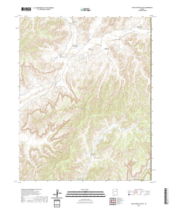
2021 Map of Hole In Rock Valley
USGS Topo · Published 2021About this map
Hole in Rock Valley characterizes this high-desert landscape in northeastern Arizona, where a complex network of ephemeral drainage systems carves through the Navajo County terrain. The northern reaches are defined by the Celebration Wash and the West Fork Oraibi Wash, while the southern portion transitions into the deeper recesses of Devils Canyon and the Wepo Valley. The names themselves tell a story of the difficulties and small reliefs found in this environment, from the aptly named Pain in the Back Canyon and Alkali Valley to the shelter suggested by Aspen Grove Wash. Infrastructure is minimal, limited largely to Indian Rte 8066 and its local connectors, reflecting a remote area where the land's natural contours and watercourses remain the primary landmarks for navigation and land use.
Find a feature on this map
20 named features on this map. Tap any name to fly to it.
Don’t see what you’re looking for? This feature index may not catch every label — zoom into the map to look around manually.
Map Details
Editions of this 2021 Hole In Rock Valley Map
This is the sole edition of this map. No revisions or reprints were ever made.
Other maps of this area

1883 · Marsh Pass
USGS Topo · 1:250,000

1892 · Marsh Pass
USGS Topo · 1:250,000

1892 · Canyon De Chelly
USGS Topo · 1:250,000

1954 · Shiprock
USGS Topo · 1:250,000

1956 · Marble Canyon
USGS Topo · 1:250,000

1958 · Shiprock
USGS Topo · 1:250,000

1959 · Shiprock
USGS Topo · 1:250,000

1959 · Marble Canyon
USGS Topo · 1:250,000

1961 · Marble Canyon
USGS Topo · 1:250,000
1967 · Pinon NW
USGS Topo · 1:24,000