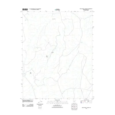
2011 Map of Hole-n-Wall Canyon
USGS Topo · Published 2011About this map
Swiss Canyon and the surrounding high desert of Mohave County define this 2011 survey, where the landscape is marked more by water management than by permanent settlement. The namesake Hole-n-Wall Canyon is a central geological feature, leading toward the Hole-n-Wall Reservoir and the broad expanse of Main Street Valley. In this arid environment, the survival of ranching or local travel is evidenced by numerous named catchment points such as Dutchman Tank, Pocum Tank, and Gravel Draw Pond. The presence of Seegmiller Spring and Clay Spring suggests the historic importance of reliable water sources in an otherwise dry terrain. Transportation across these flats is facilitated by routes like Sunshine Trail Rd, which provides access to remote areas like Dutchman Flat and the vicinity of Sunshine Pond.
Find a feature on this map
13 named features on this map. Tap any name to fly to it.
Don’t see what you’re looking for? This feature index may not catch every label — zoom into the map to look around manually.
Map Details
Editions of this 2011 Hole-n-Wall Canyon Map
This is the sole edition of this map. No revisions or reprints were ever made.
Other maps of this area

1886 · Mt. Trumbull
USGS Topo · 1:250,000

1892 · Mt. Trumbull
USGS Topo · 1:250,000

1953 · Grand Canyon
USGS Topo · 1:250,000

1954 · Hurricane Cliffs 2 NW
USGS Topo · 1:24,000

1954 · Hurricane Cliffs 2 NE
USGS Topo · 1:24,000

1954 · Wolf Hole Mtn. NE
USGS Topo · 1:24,000

1957 · Grand Canyon
USGS Topo · 1:250,000

1958 · Grand Canyon
USGS Topo · 1:250,000

1960 · Grand Canyon
USGS Topo · 1:250,000
1979 · Sullivan Draw North
USGS Topo · 1:24,000