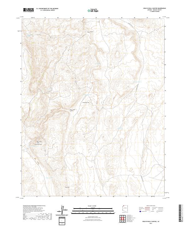
2021 Map of Hole-n-Wall Canyon
USGS Topo · Published 2021About this map
Hole-n-Wall Canyon and the neighboring Main Street Valley define the drainage patterns of this Mohave County landscape, where water management is central to the local geography. The map documents a network of vital water sources including Seegmiller Spring, Clay Spring, and several man-made improvements such as the Hole-n-Wall Reservoir and Dutchman Tank. These features suggest a history of ranching or land management in an arid environment, where every spring and catchment was critical for survival and movement.
Find a feature on this map
19 named features on this map. Tap any name to fly to it.
Don’t see what you’re looking for? This feature index may not catch every label — zoom into the map to look around manually.
Map Details
Editions of this 2021 Hole-n-Wall Canyon Map
This is the sole edition of this map. No revisions or reprints were ever made.
Other maps of this area

1886 · Mt. Trumbull
USGS Topo · 1:250,000

1892 · Mt. Trumbull
USGS Topo · 1:250,000

1953 · Grand Canyon
USGS Topo · 1:250,000

1954 · Hurricane Cliffs 2 NW
USGS Topo · 1:24,000

1954 · Hurricane Cliffs 2 NE
USGS Topo · 1:24,000

1954 · Wolf Hole Mtn. NE
USGS Topo · 1:24,000

1957 · Grand Canyon
USGS Topo · 1:250,000

1958 · Grand Canyon
USGS Topo · 1:250,000

1960 · Grand Canyon
USGS Topo · 1:250,000
1979 · Sullivan Draw North
USGS Topo · 1:24,000