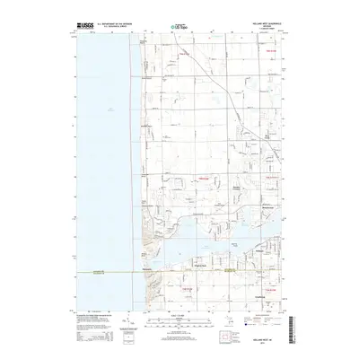
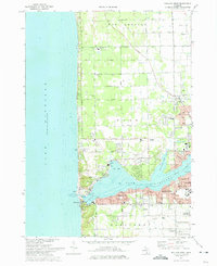
2014 Map of Holland West
USGS Topo · Published 2014About this map
The western shoreline of Lake Michigan defines this coastal region, where a string of beach communities like Rosabelle Beach, Ventura Beach, and Tennessee Beach sit atop the dunes. The landscape is dominated by the transition from the Great Lake into Lake Macatawa, which provides sheltered water for Big Bay, Macatawa Bay, and Pine Creek Bay. Settlement patterns are dense near the city of Holland, transitioning to the planned grid of Beechwood and the small crossroads at Tasmas Corners.
Find a feature on this map
69 named features on this map. Tap any name to fly to it.
Don’t see what you’re looking for? This feature index may not catch every label — zoom into the map to look around manually.
Map Details
Editions of this 2014 Holland West Map
This is the sole edition of this map. No revisions or reprints were ever made.
Other maps of this area

1928 · Fennville
USGS Topo · 1:62,500

1929 · Holland
USGS Topo · 1:62,500

1931 · Fennville
USGS Topo · 1:62,500

1932 · Holland
USGS Topo · 1:62,500

1958 · Racine
USGS Topo · 1:250,000

1962 · Racine
USGS Topo · 1:250,000
1972 · Holland East
USGS Topo · 1:24,000
1972 · Port Sheldon
USGS Topo · 1:24,000
1972 · Borculo
USGS Topo · 1:24,000
1972 · Holland West
USGS Topo · 1:24,000