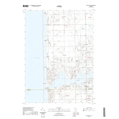
2019 Map of Holland West
USGS Topo · Published 2019About this map
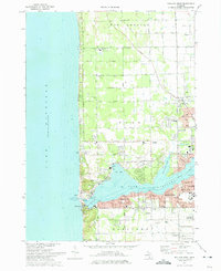
Lake Michigan dominates the western edge of this coastal landscape, where the waters of Macatawa Bay and Pine Creek Bay converge into Lake Macatawa. The shoreline is defined by a dense sequence of beach communities, including Rosabelle Beach, Tennessee Beach, and Ottawa Beach, reaching down to the specialized maritime entry at Macatawa. The interior reveals a transition from these lakefront resorts to the residential and civic structure of Holland and Graafschap to the south.
Find a feature on this map
109 named features on this map. Tap any name to fly to it.
Don’t see what you’re looking for? This feature index may not catch every label — zoom into the map to look around manually.
Map Details
Editions of this 2019 Holland West Map
This is the sole edition of this map. No revisions or reprints were ever made.
Other maps of this area

1928 · Fennville
USGS Topo · 1:62,500

1929 · Holland
USGS Topo · 1:62,500

1931 · Fennville
USGS Topo · 1:62,500

1932 · Holland
USGS Topo · 1:62,500

1958 · Racine
USGS Topo · 1:250,000

1962 · Racine
USGS Topo · 1:250,000
1972 · Holland East
USGS Topo · 1:24,000
1972 · Port Sheldon
USGS Topo · 1:24,000
1972 · Borculo
USGS Topo · 1:24,000
1972 · Holland West
USGS Topo · 1:24,000