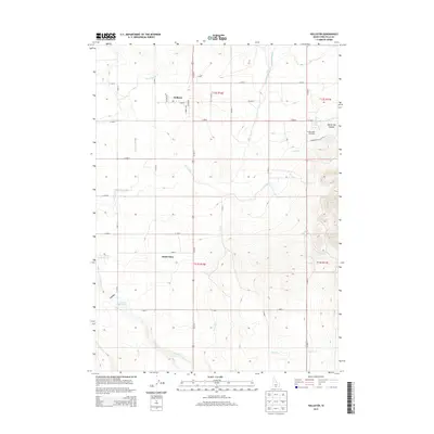
2013 Map of Hollister
USGS Topo · Published 2013About this map
The agricultural settlement of Hollister anchors the northern portion of this Twin Falls County landscape, where the high desert meets a complex network of irrigation infrastructure. This 2013 survey illustrates the critical role of water management in the region, dominated by the Main Canal and its various distributaries, including Lateral Number 21 and Lateral Number 15. The small community of Amsterdam sits further south along Us-93 N, serving as a waypoint in a landscape defined by geometric section lines and expansive ranching or farming tracts.
Find a feature on this map
41 named features on this map. Tap any name to fly to it.
Don’t see what you’re looking for? This feature index may not catch every label — zoom into the map to look around manually.
Map Details
Editions of this 2013 Hollister Map
This is the sole edition of this map. No revisions or reprints were ever made.
Other maps of this area

1955 · Twin Falls
USGS Topo · 1:250,000

1958 · Twin Falls
USGS Topo · 1:250,000

1965 · Hollister SW
USGS Topo · 1:24,000

1965 · Hollister
USGS Topo · 1:24,000

1965 · Berger
USGS Topo · 1:24,000

1965 · Berger Butte
USGS Topo · 1:24,000

1965 · Hub Butte
USGS Topo · 1:24,000

1965 · Mc Mullen Basin
USGS Topo · 1:24,000

1977 · Rogerson
USGS Topo · 1:24,000

1977 · Salmon Butte
USGS Topo · 1:24,000