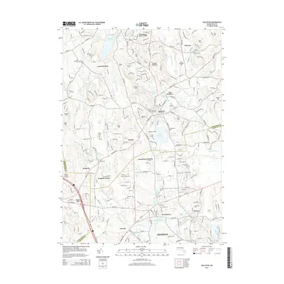
2015 Map of Holliston
USGS Topo · Published 2015About this map
The Charles River winds through this landscape of suburban growth and preserved history in the mid-2010s, bordering the bustling centers of Franklin and Medway. The map captures the dense network of local cemeteries that anchor the region's genealogy, from Saint Josephs Cem to the West Burying Ground. Transportation patterns are anchored by the legacy of the rails, seen at Braggville Station, and major local thoroughfares like Washington St and Hartford Ave.
Find a feature on this map
88 named features on this map. Tap any name to fly to it.
Don’t see what you’re looking for? This feature index may not catch every label — zoom into the map to look around manually.
Map Details
Editions of this 2015 Holliston Map
This is the sole edition of this map. No revisions or reprints were ever made.
Other maps of this area

1886 · Blackstone
USGS Topo · 1:62,500

1886 · Framingham
USGS Topo · 1:62,500

1887 · Franklin
USGS Topo · 1:62,500

1887 · Marlboro
USGS Topo · 1:62,500

1889 · Marlboro
USGS Topo · 1:62,500

1889 · Blackstone
USGS Topo · 1:62,500

1889 · Franklin
USGS Topo · 1:62,500

1889 · Framingham
USGS Topo · 1:62,500

1893 · Franklin
USGS Topo · 1:62,500

1893 · Blackstone
USGS Topo · 1:62,500