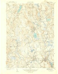
1941 Map of Holliston
USGS Topo · Published 1941About this map
Holliston sits at the heart of this pre-war survey, surrounded by a dense network of early 20th-century New England settlements and transport corridors. The landscape is defined by its glacial hydrology, with Lake Winthrop and the Ashland Reservoir serving as central landmarks. To the south, the Charles River winds past West Medway and Medway Village, anchoring the industrial and residential character of the valley.
Find a feature on this map
64 named features on this map. Tap any name to fly to it.
Don’t see what you’re looking for? This feature index may not catch every label — zoom into the map to look around manually.
Map Details
Editions of this 1941 Holliston Map
This is the sole edition of this map. No revisions or reprints were ever made.
Other maps of this area

1886 · Blackstone
USGS Topo · 1:62,500

1886 · Framingham
USGS Topo · 1:62,500

1887 · Franklin
USGS Topo · 1:62,500

1887 · Marlboro
USGS Topo · 1:62,500

1889 · Marlboro
USGS Topo · 1:62,500

1889 · Blackstone
USGS Topo · 1:62,500

1889 · Franklin
USGS Topo · 1:62,500

1889 · Framingham
USGS Topo · 1:62,500

1893 · Franklin
USGS Topo · 1:62,500

1893 · Blackstone
USGS Topo · 1:62,500