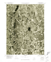
1977 Map of Holliston
USGS Topo · Published 1981About this map
Holliston and its surrounding communities are captured in this 1977 orthophotograph, which provides a detailed look at the land-use patterns of eastern Massachusetts during the late seventies. The aerial imagery highlights the transition from traditional village centers to modern suburban development, visible in the residential grids expanding around Metcalf and Gooch Corners. To the south, the winding course of the Charles River flows past West Medway and Medway, marking the southern boundary of the quadrangle. Produced by the U.S. Geological Survey in cooperation with the Massachusetts Department of Public Works, this rectified imagery reveals the specific placement of individual structures, roads, and woodlots as they stood on April 1, 1977. Local historians can use the high-contrast photographic detail to pinpoint properties near Braggville or trace the early development of the region's transportation network.
Find a feature on this map
7 named features on this map. Tap any name to fly to it.
Don’t see what you’re looking for? This feature index may not catch every label — zoom into the map to look around manually.
Map Details
Editions of this 1977 Holliston Map
This is the sole edition of this map. No revisions or reprints were ever made.
Other maps of this area

1886 · Blackstone
USGS Topo · 1:62,500

1886 · Framingham
USGS Topo · 1:62,500

1887 · Franklin
USGS Topo · 1:62,500

1887 · Marlboro
USGS Topo · 1:62,500

1889 · Marlboro
USGS Topo · 1:62,500

1889 · Blackstone
USGS Topo · 1:62,500

1889 · Franklin
USGS Topo · 1:62,500

1889 · Framingham
USGS Topo · 1:62,500

1893 · Franklin
USGS Topo · 1:62,500

1893 · Blackstone
USGS Topo · 1:62,500