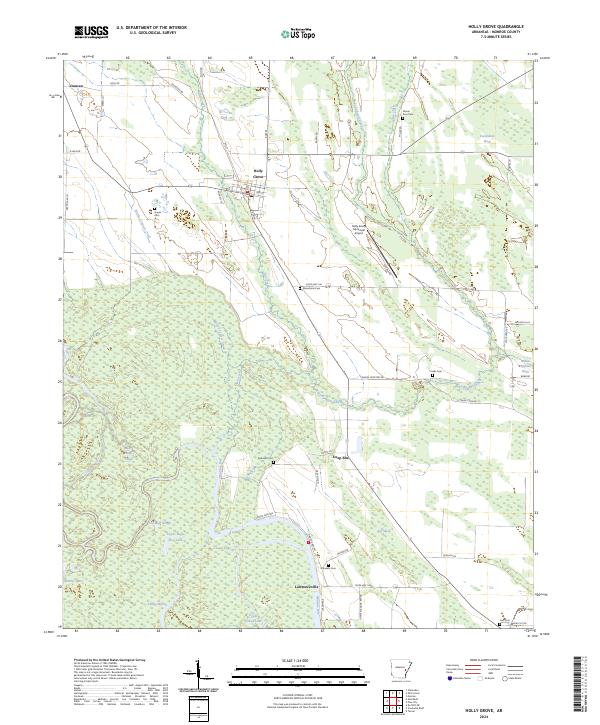
1974 Map of Holly Grove
USGS Topo · Published 1974About this map
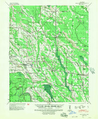
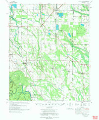
The Louisiana Purchase Monument stands as a focal point in this 1970s landscape, marking the historic initial point for surveys of the American West at the junction of Monroe, Lee, and Phillips counties. The area around Holly Grove is defined by a complex drainage network including Big Cypress Creek and the floodplains of Warrior Bottom, which are interspersed with numerous Fish Farm operations and Minnow Ponds. Settlement patterns are anchored by the Missouri Pacific railroad line, which connects the town of Monroe to Blackton and Postelle. Local history is deeply embedded in the rural landscape through a high density of country churches and family-named cemeteries, such as Big Star Ch, Franks Cem, and the Macedonia Cem. Further south, the map details the riverine geography near Lawrenceville, where Upper Eagle Nest Lake and Maddox Lake demonstrate the shifting nature of the region's waterways.
Find a feature on this map
55 named features on this map. Tap any name to fly to it.
Don’t see what you’re looking for? This feature index may not catch every label — zoom into the map to look around manually.
Map Details
Editions of this 1974 Holly Grove Map
This is the sole edition of this map. No revisions or reprints were ever made.
Historical Maps of Holly Grove Through Time
9 maps found