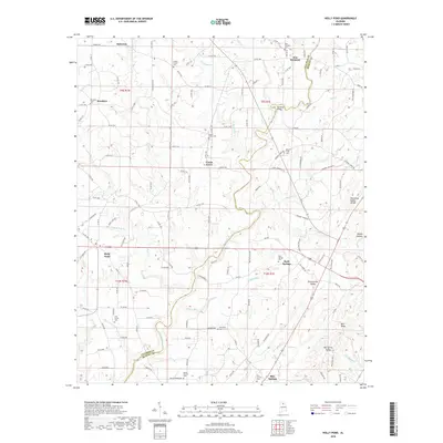
2018 Map of Holly Pond
USGS Topo · Published 2018About this map
Holly Pond serves as a primary hub in this corner of North Alabama, situated where the ridge terrain begins to drop toward the Blountsville Valley. The landscape is defined by the Tennessee Valley Divide, which separates the headwaters of various local creeks. The Mulberry Fork winds through the northern sections, crossed by the Rockhole Bridge, while numerous cemeteries like Union Grove Cem and New Harmony Cem are tucked into the hillsides. The map captures the interface between the Blue Ridge and the broad agricultural valleys below. Small settlements such as Baileyton, Brooklyn, and Rock Springs are connected by a network of county roads that follow the winding topography. This area, spanning the border of Cullman Co and Blount Co, reflects a long-established rural pattern of upland farming and small-town community centers centered around local churches and burial grounds.
Find a feature on this map
138 named features on this map. Tap any name to fly to it.
Don’t see what you’re looking for? This feature index may not catch every label — zoom into the map to look around manually.
Map Details
Editions of this 2018 Holly Pond Map
This is the sole edition of this map. No revisions or reprints were ever made.
Other maps of this area

1885 · Gadsden
USGS Topo · 1:125,000

1888 · Cullman
USGS Topo · 1:125,000

1888 · Gadsden
USGS Topo · 1:125,000

1892 · Cullman
USGS Topo · 1:125,000

1892 · Gadsden
USGS Topo · 1:125,000

1895 · Gadsden
USGS Topo · 1:125,000

1903 · Gadsden
USGS Topo · 1:125,000

1936 · Hulaco
USGS Topo · 1:24,000

1936 · Arab
USGS Topo · 1:24,000

1936 · Lawrence Cove
USGS Topo · 1:24,000