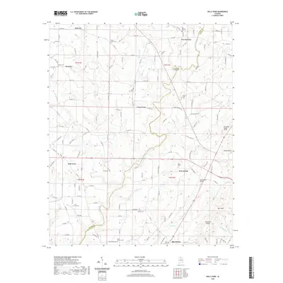
2020 Map of Holly Pond
USGS Topo · Published 2020About this map
Holly Pond serves as a central hub in this corner of Northeast Alabama, situated along the Tennessee Valley Divide where the waters split toward different drainage basins. The landscape is defined by the distinct geological corridors of Blountsville Valley and Big Spring Valley, which channel small waterways like Copeland Cr and Blue Springs Cr toward the Mulberry Fork. This 2020 survey documents a rural mosaic of small settlements and family-named landmarks, such as Gandy Hollow and Blue Ridge.
Find a feature on this map
141 named features on this map. Tap any name to fly to it.
Don’t see what you’re looking for? This feature index may not catch every label — zoom into the map to look around manually.
Map Details
Editions of this 2020 Holly Pond Map
This is the sole edition of this map. No revisions or reprints were ever made.
Other maps of this area

1885 · Gadsden
USGS Topo · 1:125,000

1888 · Cullman
USGS Topo · 1:125,000

1888 · Gadsden
USGS Topo · 1:125,000

1892 · Cullman
USGS Topo · 1:125,000

1892 · Gadsden
USGS Topo · 1:125,000

1895 · Gadsden
USGS Topo · 1:125,000

1903 · Gadsden
USGS Topo · 1:125,000

1936 · Hulaco
USGS Topo · 1:24,000

1936 · Arab
USGS Topo · 1:24,000

1936 · Lawrence Cove
USGS Topo · 1:24,000