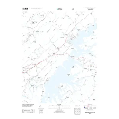
2013 Map of Holston Valley
USGS Topo · Published 2013About this map
South Holston Lake dominates this landscape northeast of Bristol, where the S Fork Holston River is impounded amidst a series of prominent ridges and knobs. The map documents numerous lakeside access points and landmarks, including the American Legion Memorial Bridge and several regional sites like Presbytery Camp, Sequoya Camp, and the Little Oak Recreation Area. Smaller settlements and locally-named junctions such as Goose Pimple Junction, Holston Valley, and Friendship are scattered throughout the valley floors, connected by a network of rural routes like King Mill Pike and Old Jonesboro Rd. Historical infrastructure is visible through the Bristol Waterworks near Emmett and the namesake King Mill on Spring Cr. The terrain is characterized by named elevations such as Grandfather Knob, Big Oak Mountain, and McConnell Ridge, illustrating the complex topography of the Tennessee-Virginia borderlands.
Find a feature on this map
73 named features on this map. Tap any name to fly to it.
Don’t see what you’re looking for? This feature index may not catch every label — zoom into the map to look around manually.
Map Details
Editions of this 2013 Holston Valley Map
This is the sole edition of this map. No revisions or reprints were ever made.
Other maps of this area

1891 · Roan Mountain
USGS Topo · 1:125,000

1891 · Abingdon
USGS Topo · 1:125,000

1893 · Cranberry
USGS Topo · 1:125,000

1894 · Roan Mountain
USGS Topo · 1:125,000

1894 · Abingdon
USGS Topo · 1:125,000

1895 · Cranberry
USGS Topo · 1:125,000

1897 · Bristol
USGS Topo · 1:125,000

1899 · Cranberry
USGS Topo · 1:125,000

1902 · Bristol
USGS Topo · 1:125,000

1902 · Cranberry
USGS Topo · 1:125,000