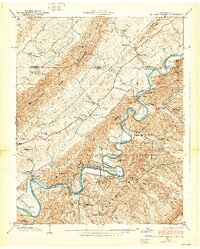
1938 Map of Holston Valley
USGS Topo · Published 1938About this map
The South Fork Holston River defines this 1938 landscape, winding through a complex series of ridges including The Knobs and the Paperville Knobs. At this time, the valley is a dense network of small rural communities and family-centered landmarks. River crossings like Minnick Ford and Whitlock Ford remain vital, while the Bristol Water Works and King Mill suggest the local industrial and utility infrastructure near the Virginia-Tennessee border.
Find a feature on this map
95 named features on this map. Tap any name to fly to it.
Don’t see what you’re looking for? This feature index may not catch every label — zoom into the map to look around manually.
Map Details
Editions of this 1938 Holston Valley Map
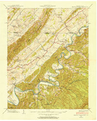
2 editions found
Other maps of this area

1891 · Roan Mountain
USGS Topo · 1:125,000

1891 · Abingdon
USGS Topo · 1:125,000

1893 · Cranberry
USGS Topo · 1:125,000

1894 · Roan Mountain
USGS Topo · 1:125,000

1894 · Abingdon
USGS Topo · 1:125,000

1895 · Cranberry
USGS Topo · 1:125,000

1897 · Bristol
USGS Topo · 1:125,000

1899 · Cranberry
USGS Topo · 1:125,000

1902 · Bristol
USGS Topo · 1:125,000

1902 · Cranberry
USGS Topo · 1:125,000