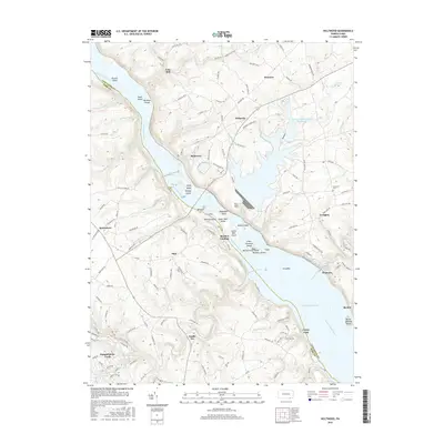
2016 Map of Holtwood
USGS Topo · Published 2016About this map
The Susquehanna River dominates this 2016 study of the border between Lancaster and York counties, where a complex network of islands and dammed waters defines the geography. Large impoundments like Lake Aldred and Conowingo Reservoir have altered the original river course, though historical points of interest like Boeckel Landing and Coyne Lock remain as markers of the area's river-navigating past. The interior landscape is dotted with small settlements such as Bethesda, Slab, and Sunnyburn, linked by rural routes like McCalls Ferry Rd.
Find a feature on this map
132 named features on this map. Tap any name to fly to it.
Don’t see what you’re looking for? This feature index may not catch every label — zoom into the map to look around manually.
Map Details
Editions of this 2016 Holtwood Map
This is the sole edition of this map. No revisions or reprints were ever made.
Other maps of this area

1900 · Havre De Grace
USGS Topo · 1:62,500

1901 · Belair
USGS Topo · 1:62,500

1912 · Quarryville
USGS Topo · 1:62,500

1912 · Mc Calls Ferry
USGS Topo · 1:62,500

1942 · Havre De Grace
USGS Topo · 1:62,500

1942 · Bel Air
USGS Topo · 1:62,500

1943 · Quarryville
USGS Topo · 1:62,500

1943 · Mc Calls Ferry
USGS Topo · 1:62,500

1945 · Bel Air
USGS Topo · 1:62,500

1948 · Baltimore
USGS Topo · 1:250,000
Featured Places
- Drumore Township, PA
- Fulton Township, PA
- Peach Bottom Township, PA
- Lower Chanceford Township, PA
- Providence Township, PA