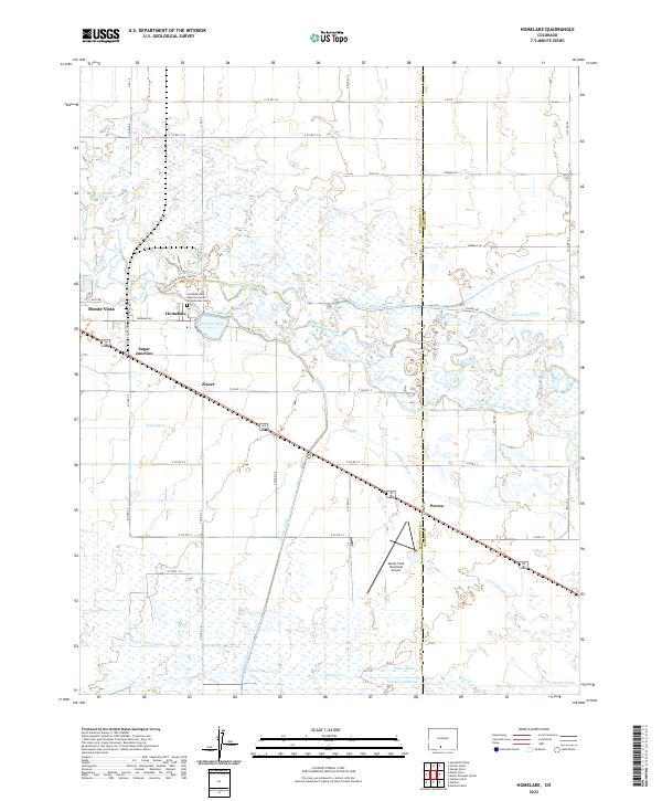
2022 Map of Homelake
USGS Topo · Published 2022About this map
The Rio Grande flows through this San Luis Valley landscape, defining a region where water management is central to the local geography. The map documents an intricate network of irrigation systems, including the San Luis Valley Canal, Billings Ditch, and Empire Canal, which support the agricultural life around Monte Vista. A significant cultural landmark is the Colorado State Veterans Center at Homelake Cem, situated near the settlement of Homelake. Small rail and road junctions like Sugar Junction, Zinzer, and Parma dot the corridors between the county line of Rio Grande Co and Alamosa Co. The terrain is also home to the Monte Vista Municipal Airport and the Shriver and Wright SWA Trl, illustrating the mix of aviation infrastructure and state wildlife areas that characterize this high-altitude valley.
Find a feature on this map
64 named features on this map. Tap any name to fly to it.
Don’t see what you’re looking for? This feature index may not catch every label — zoom into the map to look around manually.
Map Details
Editions of this 2022 Homelake Map
This is the sole edition of this map. No revisions or reprints were ever made.
Other maps of this area

1915 · Del Norte
USGS Topo · 1:125,000

1917 · Del Norte
USGS Topo · 1:125,000

1922 · Conejos
USGS Topo · 1:125,000

1945 · Durango
USGS Topo · 1:250,000

1953 · Durango
USGS Topo · 1:250,000

1954 · Durango
USGS Topo · 1:250,000

1954 · Trinidad
USGS Topo · 1:250,000

1955 · Trinidad
USGS Topo · 1:250,000

1958 · Trinidad
USGS Topo · 1:250,000

1959 · Trinidad
USGS Topo · 1:250,000