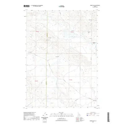
2020 Map of Homer Valley
USGS Topo · Published 2020About this map
Caribou Range foothills dominate the horizon in this high-altitude landscape where Homer Valley and Outlet Valley provide relatively level ground amidst complex terrain. The drainage patterns of the region are defined by the Grays Lake Outlet, which winds through the valley floors, joined by numerous seasonal streams including Chicken Cr and Brockman Cr. Notable elevations like Sugarloaf Mtn, Outlet Ridge, and the uniquely named Particular Knoll serve as significant landmarks for those navigating the backcountry.
Find a feature on this map
28 named features on this map. Tap any name to fly to it.
Don’t see what you’re looking for? This feature index may not catch every label — zoom into the map to look around manually.
Map Details
Editions of this 2020 Homer Valley Map
This is the sole edition of this map. No revisions or reprints were ever made.
Other maps of this area

1917 · Cranes Flat
USGS Topo · 1:62,500

1924 · Hell Creek
USGS Topo · 1:62,500

1926 · Hell Creek
USGS Topo · 1:62,500

1932 · Irwin
USGS Topo · 1:96,000

1935 · Irwin
USGS Topo · 1:125,000

1955 · Driggs
USGS Topo · 1:250,000

1958 · Driggs
USGS Topo · 1:250,000

1962 · Driggs
USGS Topo · 1:250,000
1966 · Bear Island
USGS Topo · 1:24,000
1966 · Herman
USGS Topo · 1:24,000