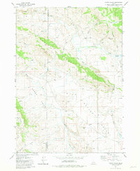
1981 Map of Homer Valley
USGS Topo · Published 1981About this map
Grays Lake Outlet dominates this high-country landscape, carving a prominent valley through the high ridges of southeast Idaho. The 1981 survey documents a terrain defined by water and grazing, where numerous mountain streams like Twin Pines Creek and Sawmill Creek feed into the central drainage system. The area is marked by distinctive elevations such as Sugarloaf Mtn and Sheep Mountain, while the presence of several corrals and isolated storage bins suggests a land primarily utilized for seasonal ranching and livestock management. This map records the intersection of Bingham and Bonneville counties during a period when the infrastructure remained largely rural and utilitarian. Human activity is further evidenced by the Cinder Pit near Homer Creek and a network of 4WD trails, including Cranes Flat Road, which provided the primary access for land management and resource extraction in this remote part of the state.
Find a feature on this map
24 named features on this map. Tap any name to fly to it.
Don’t see what you’re looking for? This feature index may not catch every label — zoom into the map to look around manually.
Map Details
Editions of this 1981 Homer Valley Map
This is the sole edition of this map. No revisions or reprints were ever made.
Other maps of this area

1917 · Cranes Flat
USGS Topo · 1:62,500

1924 · Hell Creek
USGS Topo · 1:62,500

1926 · Hell Creek
USGS Topo · 1:62,500

1932 · Irwin
USGS Topo · 1:96,000

1935 · Irwin
USGS Topo · 1:125,000

1955 · Driggs
USGS Topo · 1:250,000

1958 · Driggs
USGS Topo · 1:250,000

1962 · Driggs
USGS Topo · 1:250,000
1966 · Bear Island
USGS Topo · 1:24,000
1966 · Herman
USGS Topo · 1:24,000