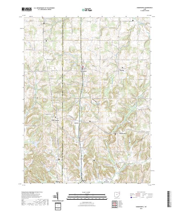
2023 Map of Homeworth
USGS Topo · Published 2023About this map
Middle Branch Sandy Creek winds through the heart of this rural landscape where the border of Stark and Columbiana counties meets. The settlement of Homeworth serves as a central hub, surrounded by several smaller historic hamlets including Moultrie, Reading, and New Franklin. These communities are often marked by their ancestral burial grounds, such as Moultrie Chapel Cem and the Friends of Fairmount Cem, which provide significant points of interest for genealogists tracing family roots in the region. The terrain is characterized by a network of drainage ways like Beaver Run and Hugle Run that feed into the larger creek system, interspersed with small bodies of water like Woodland Lake. While primarily agricultural, the inclusion of the Crosswind Meadows Airport near Chambersburg reflects the modern intersection of traditional rural land use and local aviation infrastructure.
Find a feature on this map
108 named features on this map. Tap any name to fly to it.
Don’t see what you’re looking for? This feature index may not catch every label — zoom into the map to look around manually.
Map Details
Editions of this 2023 Homeworth Map
This is the sole edition of this map. No revisions or reprints were ever made.
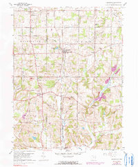
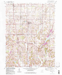
Historical Maps of Homeworth Through Time
3 maps found