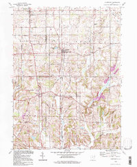
1994 Map of Homeworth
USGS Topo · Published 1998About this map
Homeworth serves as a central hub on this landscape, positioned along the Middle Branch Sandy Creek near the Stark Co Columbiana Co line. The area reflects a well-established rural social structure, anchored by historic institutions like the Fairmount Childrens Home and the adjacent Fairmount Mem Park (Cem). Small crossroads communities such as New Franklin, Moultrie, and Chambersburg are interconnected by a grid of named roads like Georgetown Street and Center Road, which serve the scattered family farms and country churches.
Find a feature on this map
49 named features on this map. Tap any name to fly to it.
Don’t see what you’re looking for? This feature index may not catch every label — zoom into the map to look around manually.
Map Details
Editions of this 1994 Homeworth Map
This is the sole edition of this map. No revisions or reprints were ever made.
Other maps of this area

1905 · Salineville
USGS Topo · 1:62,500

1909 · Alliance
USGS Topo · 1:62,500

1909 · Lisbon
USGS Topo · 1:62,500

1910 · Carrollton
USGS Topo · 1:62,500

1912 · Carrollton
USGS Topo · 1:62,500

1951 · Canton
USGS Topo · 1:250,000

1952 · Alliance
USGS Topo · 1:24,000

1952 · Damascus
USGS Topo · 1:24,000

1953 · Canton
USGS Topo · 1:250,000

1957 · Canton
USGS Topo · 1:250,000