
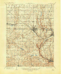
1909 Map of Lisbon
USGS Topo · Published 1937About this map
Salem serves as the industrial and transit hub of this early twentieth-century landscape, where the Pennsylvania System and Youngstown and Ohio River RR meet. The map reveals a densely settled agricultural region defined by a grid of townships like Goshen, Green, and Butler. To the north, the South Boundary Connecticut Reserve line marks a significant historical surveying boundary that shaped the original layout of these counties.
Find a feature on this map
73 named features on this map. Tap any name to fly to it.
Don’t see what you’re looking for? This feature index may not catch every label — zoom into the map to look around manually.
Map Details
Editions of this 1909 Lisbon Map
2 editions found
Other maps of this area

1904 · Wellsville
USGS Topo · 1:62,500

1905 · Salineville
USGS Topo · 1:62,500

1906 · Youngstown
USGS Topo · 1:62,500

1906 · Ravenna
USGS Topo · 1:62,500

1907 · Columbiana
USGS Topo · 1:62,500

1908 · Youngstown
USGS Topo · 1:62,500

1908 · Warren
USGS Topo · 1:62,500

1908 · Ravenna
USGS Topo · 1:62,500

1909 · Alliance
USGS Topo · 1:62,500

1909 · Columbiana
USGS Topo · 1:62,500