
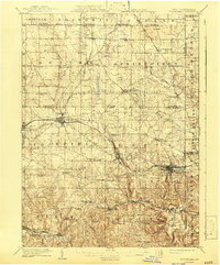
1909 Map of Columbiana
USGS Topo · Published 1937About this map
Industrial and agricultural development along the Ohio-Pennsylvania border defines this survey, where the Pennsylvania System and the Pittsburgh Lisbon and Western Railroad intersect to facilitate the region's early 20th-century economy. The landscape is dotted with small-scale rural infrastructure, from the Coalmines in Boardman to a dense network of country schools such as Subrosa School and Blue Hill School. The map reveals the early layout of manufacturing centers like East Palestine and Leetonia, as well as the transition from the flatlands of the Connecticut Reserve in the north to the more dissected valleys of Little Beaver Creek in the south. Genealogists will find interest in the numerous named landmarks, including Mt Zion Church and several community hubs like New Waterford and North Lima, which served the farming and mining families of the era.
Find a feature on this map
78 named features on this map. Tap any name to fly to it.
Don’t see what you’re looking for? This feature index may not catch every label — zoom into the map to look around manually.
Map Details
Editions of this 1909 Columbiana Map
2 editions found
Other maps of this area

1901 · Beaver
USGS Topo · 1:62,500

1902 · New Castle
USGS Topo · 1:62,500

1904 · Newcastle
USGS Topo · 1:62,500

1904 · Wellsville
USGS Topo · 1:62,500

1904 · Beaver
USGS Topo · 1:62,500

1905 · Salineville
USGS Topo · 1:62,500

1905 · Neshannock
USGS Topo · 1:62,500

1906 · Youngstown
USGS Topo · 1:62,500

1907 · Neshannock
USGS Topo · 1:62,500

1907 · Columbiana
USGS Topo · 1:62,500