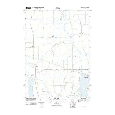
2010 Map of Honeoye
USGS Topo · Published 2010About this map
Honeoye Lake and Hemlock Lake anchor this 2010 topographic record of the Finger Lakes region, where the terrain transitions from steep gullies like Abbey Gulf to the fertile fields of Coye Field. The settlement pattern reflects a deeply rooted agricultural and rural community, with small corners such as Bosley Corner, Curtis Corner, and Dennison Corner serving as local landmarks. The presence of numerous family and community burial grounds, including the Purcell Cemetery and Short Cemetery, provides valuable data for genealogists tracing early residents of the area around Richmond Center.
Find a feature on this map
82 named features on this map. Tap any name to fly to it.
Don’t see what you’re looking for? This feature index may not catch every label — zoom into the map to look around manually.
Map Details
Editions of this 2010 Honeoye Map
This is the sole edition of this map. No revisions or reprints were ever made.
Other maps of this area

1900 · Naples
USGS Topo · 1:62,500

1900 · Canandaigua
USGS Topo · 1:62,500

1901 · Honeoye
USGS Topo · 1:62,500

1902 · Wayland
USGS Topo · 1:62,500

1903 · Naples
USGS Topo · 1:62,500

1903 · Canandaigua
USGS Topo · 1:62,500

1904 · Wayland
USGS Topo · 1:62,500

1904 · Honeoye
USGS Topo · 1:62,500

1913 · Naples
USGS Topo · 1:62,500

1934 · Rush
USGS Topo · 1:24,000