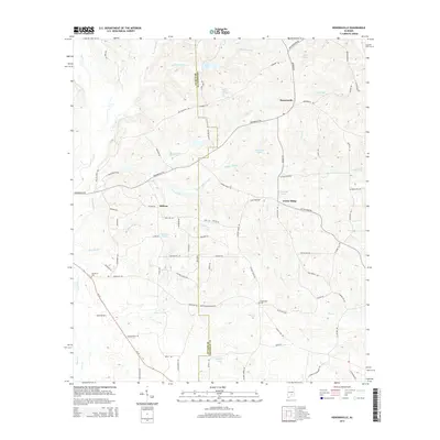
2014 Map of Honoraville
USGS Topo · Published 2014About this map
Honoraville and Midway anchor this section of the Alabama coastal plain along the border of Butler and Crenshaw counties. The landscape is defined by a dense network of minor waterways and named ponds, such as Ropers Pond, Lake Jane, and Sims Pond, which drain the varied topography of Center Ridge. A clear pattern of rural development is visible through numerous family-named landmarks and local transit routes. Genealogists can identify key burial sites like Damascus Cem near the Damascus settlement and Black Rock Cem to the east. The terrain is crisscrossed by established local roads including Hickory Grove Rd and Center Ridge Rd, which connect scattered homesteads to the primary thoroughfare, Al-10. Drainage features like Skipper Mill Br and Hatchee-Br suggest a history of small-scale water management and land use typical of the region's agricultural past.
Find a feature on this map
81 named features on this map. Tap any name to fly to it.
Don’t see what you’re looking for? This feature index may not catch every label — zoom into the map to look around manually.
Map Details
Editions of this 2014 Honoraville Map
This is the sole edition of this map. No revisions or reprints were ever made.
Other maps of this area

1953 · Andalusia
USGS Topo · 1:250,000

1957 · Andalusia
USGS Topo · 1:250,000

1971 · Luverne
USGS Topo · 1:24,000

1971 · Fullers Crossroads
USGS Topo · 1:24,000

1971 · Pigeon Creek
USGS Topo · 1:24,000

1971 · Fort Deposit
USGS Topo · 1:24,000

1971 · Honoraville
USGS Topo · 1:24,000

1971 · Moodys Crossroads
USGS Topo · 1:24,000

1971 · Greenville East
USGS Topo · 1:24,000

1971 · Danielsville
USGS Topo · 1:24,000