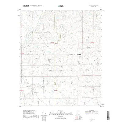
2020 Map of Honoraville
USGS Topo · Published 2020About this map
The rolling hills of south-central Alabama are defined here by a dense network of minor waterways including Pigeon Cr and Tater Cr. The landscape transitions from the dense Pigeon Creek Swamp in the west toward the crossroads settlements of Honoraville, Midway, and Center Ridge. The county line between Butler Co and Crenshaw Co bisects the area, following natural drainage divides and section lines through a region largely shaped by timber and agriculture. Numerous named ponds, such as Lake Jane, Ropers Pond, and Russells Pond, suggest a history of local land management and water usage. Family roots can be traced through the presence of Damascus Cem near the western border and Black Rock Cem to the south. The road network, featuring names like Honoraville Rd and Jackson Trail Rd, reveals the historic routes connecting these small rural communities.
Find a feature on this map
90 named features on this map. Tap any name to fly to it.
Don’t see what you’re looking for? This feature index may not catch every label — zoom into the map to look around manually.
Map Details
Editions of this 2020 Honoraville Map
This is the sole edition of this map. No revisions or reprints were ever made.
Other maps of this area

1953 · Andalusia
USGS Topo · 1:250,000

1957 · Andalusia
USGS Topo · 1:250,000

1971 · Luverne
USGS Topo · 1:24,000

1971 · Fullers Crossroads
USGS Topo · 1:24,000

1971 · Pigeon Creek
USGS Topo · 1:24,000

1971 · Fort Deposit
USGS Topo · 1:24,000

1971 · Honoraville
USGS Topo · 1:24,000

1971 · Moodys Crossroads
USGS Topo · 1:24,000

1971 · Greenville East
USGS Topo · 1:24,000

1971 · Danielsville
USGS Topo · 1:24,000