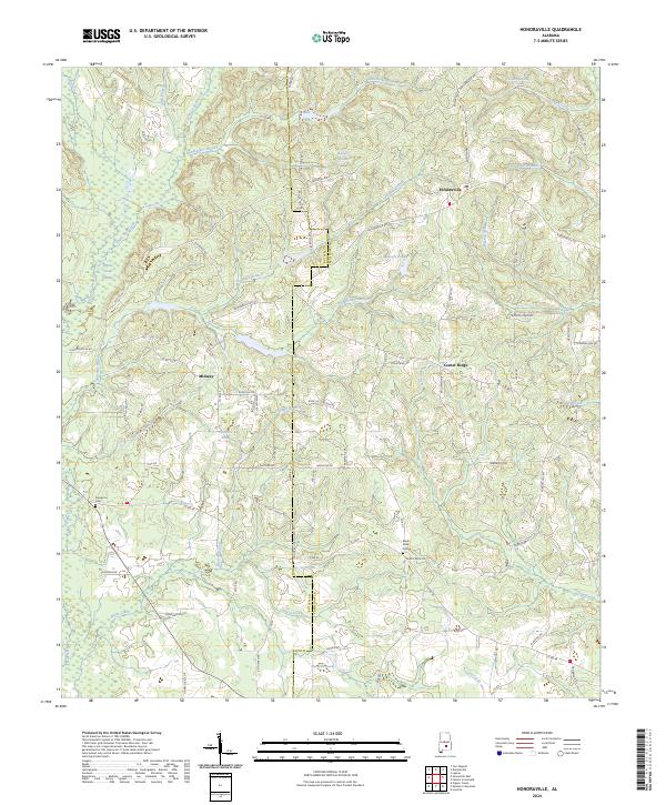
2024 Map of Honoraville
USGS Topo · Published 2024About this map
Honoraville serves as the central hub of this modern survey, marking a corner of the Butler Co / Crenshaw Co line. The landscape is defined by its intricate network of small drainages and family-named water bodies, such as Masseys Pond and Cumbies Pond. This region of rural Alabama maintains a distinct settlement pattern where small communities like Midway and Center Ridge are linked by a web of local routes including Honoraville Rd and Jackson Trail Rd. Local historians and genealogists will find value in the specific locations of long-standing burial grounds such as Damascus Cem and Black Rock Cem. The western edge is dominated by the Pigeon Creek Swamp, while the interior terrain is marked by dozens of named branches like Rattlesnake Branch and Skipper Mill Branch, suggesting the historical importance of these water sources to the local agricultural economy.
Find a feature on this map
89 named features on this map. Tap any name to fly to it.
Don’t see what you’re looking for? This feature index may not catch every label — zoom into the map to look around manually.
Map Details
Editions of this 2024 Honoraville Map
This is the sole edition of this map. No revisions or reprints were ever made.
Other maps of this area

1953 · Andalusia
USGS Topo · 1:250,000

1957 · Andalusia
USGS Topo · 1:250,000

1971 · Luverne
USGS Topo · 1:24,000

1971 · Fullers Crossroads
USGS Topo · 1:24,000

1971 · Pigeon Creek
USGS Topo · 1:24,000

1971 · Fort Deposit
USGS Topo · 1:24,000

1971 · Honoraville
USGS Topo · 1:24,000

1971 · Moodys Crossroads
USGS Topo · 1:24,000

1971 · Greenville East
USGS Topo · 1:24,000

1971 · Danielsville
USGS Topo · 1:24,000