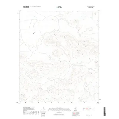
2019 Map of Hood Spring
USGS Topo · Published 2019About this map
Hood Spring and Kincaid Spring serve as the primary hydrologic landmarks in this arid stretch of Brewster County, providing critical water sources in a landscape defined by deep drainage systems. The map detail highlights a complex network of seasonal watercourses, including the westward flow of Bacon Draw and the more prominent Indian Cr and San Francisco Cr to the north. A significant geographical feature is Kincaid Creek, which meanders through the central and eastern portions of the quadrangle. These features illustrate the essential relationship between water access and land use in West Texas, where named springs often dictated the location of early camps and stock ranges. The lack of built infrastructure emphasizes the character of the region as a working ranching landscape or wilderness area during the early 21st century.
Find a feature on this map
7 named features on this map. Tap any name to fly to it.
Don’t see what you’re looking for? This feature index may not catch every label — zoom into the map to look around manually.
Map Details
Editions of this 2019 Hood Spring Map
This is the sole edition of this map. No revisions or reprints were ever made.
Other maps of this area

1917 · Hood Spring
USGS Topo · 1:62,500

1918 · Bone Spring
USGS Topo · 1:125,000

1918 · Hood Spring
USGS Topo · 1:62,500

1918 · Dove Mountain
USGS Topo · 1:62,500

1920 · Longfellow
USGS Topo · 1:125,000

1920 · Marathon
USGS Topo · 1:62,500

1921 · Marathon
USGS Topo · 1:62,500

1931 · Hood Spring
USGS Topo · 1:62,500

1954 · Fort Stockton
USGS Topo · 1:250,000

1958 · Fort Stockton
USGS Topo · 1:250,000