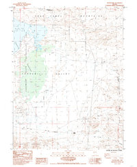
1985 Map of Hooten Well
USGS Topo · Published 1985About this map
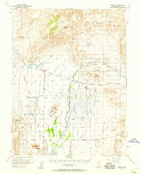
The Dead Camel Mountains rise above the high desert floor, overlooking a landscape defined by historic transit routes and the basin of Churchill Valley. This mid-1980s map documents a significant intersection of western history, showing the path of the Pony Express Road and the Simpson Express Road as they cross the arid terrain south of the Lahonton Reservoir. The presence of Desert Station and Hooten Well underscores the critical importance of reliable water and relay points in this portion of the Great Basin.
Find a feature on this map
18 named features on this map. Tap any name to fly to it.
Don’t see what you’re looking for? This feature index may not catch every label — zoom into the map to look around manually.
Map Details
Editions of this 1985 Hooten Well Map
2 editions found
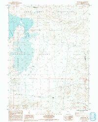
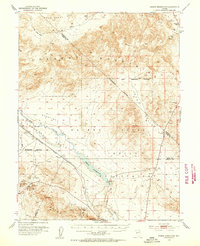
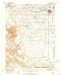
Other maps of this area

1891 · Wabuska
USGS Topo · 1:125,000

1894 · Wabuska
USGS Topo · 1:125,000

1908 · Carson Sink
USGS Topo · 1:250,000

1910 · Carson Sink
USGS Topo · 1:250,000
1951 · Weber Reservoir
USGS Topo · 1:62,500
1951 · Fallon
USGS Topo · 1:62,500
1957 · Wabuska
USGS Topo · 1:62,500
1957 · Silver Springs
USGS Topo · 1:62,500

1957 · Reno
USGS Topo · 1:250,000

1959 · Reno
USGS Topo · 1:250,000