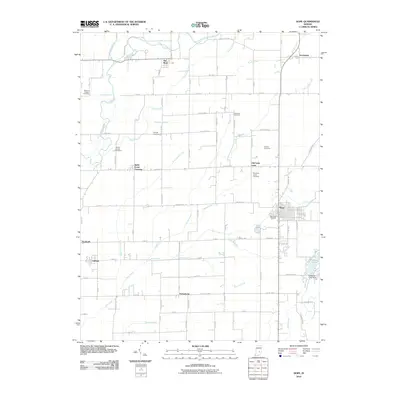
2010 Map of Hope
USGS Topo · Published 2010About this map
Hope serves as a primary hub within this agricultural landscape, defined by a grid of rural roads and scattered small settlements that speak to the region's 19th-century roots. The town's layout is centered near the Moravian Cemetery, reflecting the area's specific cultural heritage. To the northwest, the Flatrock River meanders across the plain, joined by numerous drainage systems like the Compton Ditch and Slash-Loesch Ditch, which were essential for transforming the fertile Indiana soil into productive farmland.
Find a feature on this map
88 named features on this map. Tap any name to fly to it.
Don’t see what you’re looking for? This feature index may not catch every label — zoom into the map to look around manually.
Map Details
Editions of this 2010 Hope Map
This is the sole edition of this map. No revisions or reprints were ever made.
Other maps of this area

1942 · Columbus
USGS Topo · 1:125,000

1947 · Hope
USGS Topo · 1:24,000

1948 · Edinburg
USGS Topo · 1:24,000

1948 · Hope
USGS Topo · 1:24,000

1948 · Lewis Creek
USGS Topo · 1:24,000

1948 · Marietta
USGS Topo · 1:24,000

1950 · Edinburg
USGS Topo · 1:62,500

1953 · Cincinnati
USGS Topo · 1:250,000

1956 · Waldron
USGS Topo · 1:24,000

1957 · Cincinnati
USGS Topo · 1:250,000