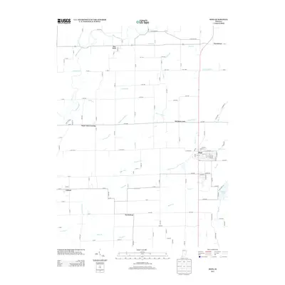
2013 Map of Hope
USGS Topo · Published 2013About this map
Hope serves as the primary municipal center in this 2013 portrait of Bartholomew County, where a grid of streets like Jackson, Main, and Seminary define the town's core. The surrounding landscape is a complex network of agricultural drainage and natural waterways, featuring an extensive system of man-made improvements like the Slash-Loesch Ditch and Chambers Ditch. These intersect with natural features such as Haw Creek and the Flatrock River in the northwest, illustrating the long-standing engineering required to manage the flat, fertile till plains of Indiana.
Find a feature on this map
111 named features on this map. Tap any name to fly to it.
Don’t see what you’re looking for? This feature index may not catch every label — zoom into the map to look around manually.
Map Details
Editions of this 2013 Hope Map
This is the sole edition of this map. No revisions or reprints were ever made.
Other maps of this area

1942 · Columbus
USGS Topo · 1:125,000
1947 · Hope
USGS Topo · 1:24,000
1948 · Edinburg
USGS Topo · 1:24,000
1948 · Hope
USGS Topo · 1:24,000
1948 · Lewis Creek
USGS Topo · 1:24,000
1948 · Marietta
USGS Topo · 1:24,000

1950 · Edinburg
USGS Topo · 1:62,500

1953 · Cincinnati
USGS Topo · 1:250,000
1956 · Waldron
USGS Topo · 1:24,000

1957 · Cincinnati
USGS Topo · 1:250,000