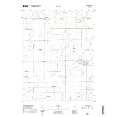
2019 Map of Hope
USGS Topo · Published 2019About this map
Hope serves as the primary hub of this eastern Bartholomew County landscape, where the town’s grid is anchored by Moravian Cem and a dense network of local streets. The surrounding territory is defined by its agricultural heritage and a high concentration of family-named burial grounds and small settlements. To the north and west, the terrain is carved by the Flatrock River and its various tributaries, including Lewis Creek and Sidney Br. The map documents a cluster of historical communities like Old Saint Louis, Flat Rock, and Saint Louis Crossing, many of which remain distinct even as the countryside is modernly subdivided. Genealogists will find particular value in the numerous recorded cemeteries, such as Spaugh Cem, Simmons Cem, and Sidener Cem, which are often the only remaining markers of the early farmstead families who established these townships. The intricate water system, featuring Slash-Loesch Ditch and Chambers Ditch, highlights the region's long-standing reliance on managed drainage for its productive farmland.
Find a feature on this map
78 named features on this map. Tap any name to fly to it.
Don’t see what you’re looking for? This feature index may not catch every label — zoom into the map to look around manually.
Map Details
Editions of this 2019 Hope Map
This is the sole edition of this map. No revisions or reprints were ever made.
Other maps of this area

1942 · Columbus
USGS Topo · 1:125,000

1947 · Hope
USGS Topo · 1:24,000

1948 · Edinburg
USGS Topo · 1:24,000

1948 · Hope
USGS Topo · 1:24,000

1948 · Lewis Creek
USGS Topo · 1:24,000

1948 · Marietta
USGS Topo · 1:24,000

1950 · Edinburg
USGS Topo · 1:62,500

1953 · Cincinnati
USGS Topo · 1:250,000

1956 · Waldron
USGS Topo · 1:24,000

1957 · Cincinnati
USGS Topo · 1:250,000