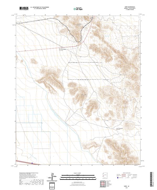
2021 Map of Hope
USGS Topo · Published 2021About this map
Hope serves as the primary landmark in this desert region of La Paz County, situated at a vital junction of local roads and desert transit routes. The landscape is defined by the stark transition from the alluvial fans of Granite Wash and Upper Bouse Wash to the abrupt rises of the Granite Wash Mountains and the Little Harquahala Mountains. A massive engineering feat, the Central Arizona Project Aqueduct cuts a distinctive diagonal path across the arid terrain, illustrating the modern management of water in the American Southwest. Local topography is anchored by prominent elevations such as Pyramid Peak, while historical transit is suggested by routes like Black Cat Pass Rd which navigates the gap at Granite Wash Pass.
Find a feature on this map
16 named features on this map. Tap any name to fly to it.
Don’t see what you’re looking for? This feature index may not catch every label — zoom into the map to look around manually.
Map Details
Editions of this 2021 Hope Map
This is the sole edition of this map. No revisions or reprints were ever made.
Other maps of this area

1942 · Vicksburg
USGS Topo · 1:250,000

1954 · Phoenix
USGS Topo · 1:250,000

1957 · Phoenix
USGS Topo · 1:250,000

1958 · Phoenix
USGS Topo · 1:250,000

1960 · Phoenix
USGS Topo · 1:250,000

1961 · Salome
USGS Topo · 1:62,500

1961 · Hope
USGS Topo · 1:62,500
1962 · Utting
USGS Topo · 1:62,500

1962 · Vicksburg
USGS Topo · 1:62,500

1969 · Phoenix
USGS Topo · 1:250,000