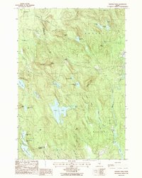
1988 Map of Hopkins Pond
USGS Topo · Published 1988About this map
The Union River and the northern reaches of Graham Lake define the eastern edge of this Hancock County landscape, where the town lines of Amherst, Clifton, Mariaville, and Otis converge. This 1988 provisional edition captures a region characterized by a dense network of glacial water bodies, from the central basin of Hopkins Pond to the chain of Upper Springy Pond, Middle Springy Pond, and Lower Springy Pond. Significant vertical relief is marked by prominent peaks such as Chick Hill, Peaked Mountain, and Saddleback Mountain, which rise sharply above the brooks and meadowlands.
Find a feature on this map
53 named features on this map. Tap any name to fly to it.
Don’t see what you’re looking for? This feature index may not catch every label — zoom into the map to look around manually.
Map Details
Editions of this 1988 Hopkins Pond Map
This is the sole edition of this map. No revisions or reprints were ever made.
Other maps of this area

1900 · Orland
USGS Topo · 1:62,500

1902 · Orono
USGS Topo · 1:62,500

1911 · Ellsworth
USGS Topo · 1:62,500

1929 · Great Pond
USGS Topo · 1:48,000

1932 · Great Pond
USGS Topo · 1:62,500

1940 · Ellsworth
USGS Topo · 1:62,500

1942 · Orland
USGS Topo · 1:62,500

1942 · Ellsworth
USGS Topo · 1:62,500

1944 · Orono
USGS Topo · 1:62,500

1946 · Orono
USGS Topo · 1:62,500