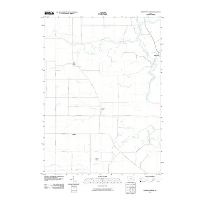
2010 Map of Hopkinton West
USGS Topo · Published 2010About this map
The Maquoketa River winds along the eastern boundary of this survey, where the western outskirts of Hopkinton meet a landscape defined by rolling agricultural tracts and a network of named waterways. Several small rural communities anchor the township corners, including Uniontown in the northwest and Argand to the south. The area’s history is preserved at sites like Buck Creek Cemetery and Grove Creek Cemetery, which serve as permanent records of the early families who settled this fertile stretch of Iowa.
Find a feature on this map
48 named features on this map. Tap any name to fly to it.
Don’t see what you’re looking for? This feature index may not catch every label — zoom into the map to look around manually.
Map Details
Editions of this 2010 Hopkinton West Map
This is the sole edition of this map. No revisions or reprints were ever made.
Other maps of this area

1890 · Anamosa
USGS Topo · 1:62,500

1891 · Monticello
USGS Topo · 1:62,500

1900 · Anamosa
USGS Topo · 1:125,000

1959 · Dubuque
USGS Topo · 1:250,000

1961 · Dubuque
USGS Topo · 1:250,000

1962 · Dubuque
USGS Topo · 1:250,000
1965 · Dyersville West
USGS Topo · 1:24,000

1966 · Hopkinton East
USGS Topo · 1:24,000
1973 · Manchester
USGS Topo · 1:24,000
1973 · Prairieburg
USGS Topo · 1:24,000