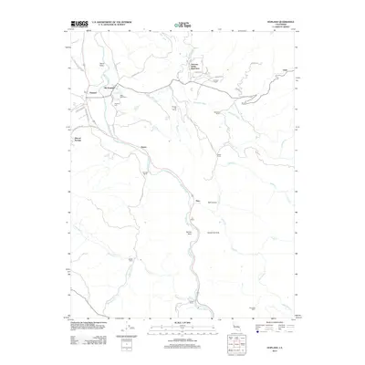
2012 Map of Hopland
USGS Topo · Published 2012About this map
The Russian River carves a deep path through Mendocino County, anchoring a landscape where agricultural ranching and indigenous heritage converge. This modern survey illustrates the transition from Old Hopland to the primary Hopland settlement along the Us-101 S corridor, highlighting the historical Rancho Del Sanel and the Nacomis Indian Rancheria. The topography is defined by the fertile Sanel Valley and McDowell Valley, which are connected by a network of historic tracks like the Old Toll Rd. Numerous named ranches, including the Buckman Ranch, McDowell Ranch, and Lambert Ranch, indicate the enduring legacy of family-held lands in this region. Along the river, landmarks like Squaw Rock and the associated Squaw Rock Slide serve as distinctive navigational markers, while small settlements such as Pieta, Oasis, and Duncan Springs dot the periphery of the major valleys.
Find a feature on this map
50 named features on this map. Tap any name to fly to it.
Don’t see what you’re looking for? This feature index may not catch every label — zoom into the map to look around manually.
Map Details
Editions of this 2012 Hopland Map
This is the sole edition of this map. No revisions or reprints were ever made.
Other maps of this area

1920 · Ukiah
USGS Topo · 1:62,500

1921 · Kelseyville
USGS Topo · 1:62,500

1938 · Lakeport
USGS Topo · 1:62,500

1938 · Hopland
USGS Topo · 1:62,500

1943 · Kelseyville
USGS Topo · 1:62,500

1943 · Hopland
USGS Topo · 1:62,500

1944 · Ukiah
USGS Topo · 1:62,500

1944 · Hopland
USGS Topo · 1:62,500

1947 · Santa Rosa
USGS Topo · 1:250,000

1949 · Santa Rosa
USGS Topo · 1:250,000