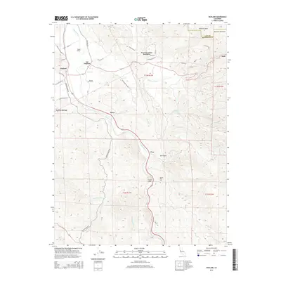
2015 Map of Hopland
USGS Topo · Published 2015About this map
The Russian River carves a deep path through southern Mendocino County, anchoring a landscape where the Sanel Valley and McDowell Valley provide pockets of level ground amidst the Mayacmas Mountains. This 2015 survey details the spatial relationship between Hopland and Old Hopland, a distinction of interest to local historians tracing the shift of the town center. The map documents the Nacomis Indian Rancheria north of the river, while landmarks like Squaw Rock and the Squaw Rock Slide overlook the winding river corridor. High-elevation points like Oasis and Duncan Springs sit on the periphery of the river valley, connected by a network of ranch roads including Pomo Ranch Rd and Mountain House Rd. Genealogists will find the Hopland Cemetery clearly marked, along with smaller settlements like Pieta and Dawes that once served as vital points along this transit route.
Find a feature on this map
49 named features on this map. Tap any name to fly to it.
Don’t see what you’re looking for? This feature index may not catch every label — zoom into the map to look around manually.
Map Details
Editions of this 2015 Hopland Map
This is the sole edition of this map. No revisions or reprints were ever made.
Other maps of this area

1920 · Ukiah
USGS Topo · 1:62,500

1921 · Kelseyville
USGS Topo · 1:62,500

1938 · Lakeport
USGS Topo · 1:62,500

1938 · Hopland
USGS Topo · 1:62,500

1943 · Kelseyville
USGS Topo · 1:62,500

1943 · Hopland
USGS Topo · 1:62,500

1944 · Ukiah
USGS Topo · 1:62,500

1944 · Hopland
USGS Topo · 1:62,500

1947 · Santa Rosa
USGS Topo · 1:250,000

1949 · Santa Rosa
USGS Topo · 1:250,000