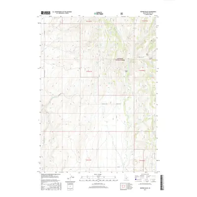
2017 Map of Hopper Gulch
USGS Topo · Published 2017About this map
Sawtooth National Forest dominates the eastern landscape of this Idaho quadrangle, where high-altitude springs and narrow gulches define the terrain of Twin Falls County. The intricate drainage network of Shoshone Creek and its many tributaries, such as Cottonwood Creek and Green Creek, shapes the local topography. This region is marked by a high density of named water sources, including Fourth of July Spring, Soldier Spring, and Lone Pine Spring, which served as critical landmarks for range management and forest navigation. The road system, featuring Magic Hot Springs Road and Basin Road, provides access through the various gulches like Bear Gulch and Arnolds Gulch. The prevalence of these springs and seasonal creeks illustrates the hydrological importance of this high-country environment within the Great Basin drainage system.
Find a feature on this map
41 named features on this map. Tap any name to fly to it.
Don’t see what you’re looking for? This feature index may not catch every label — zoom into the map to look around manually.
Map Details
Editions of this 2017 Hopper Gulch Map
This is the sole edition of this map. No revisions or reprints were ever made.
Other maps of this area

1955 · Twin Falls
USGS Topo · 1:250,000

1958 · Twin Falls
USGS Topo · 1:250,000

1965 · Hollister
USGS Topo · 1:24,000

1965 · Grand View Peak
USGS Topo · 1:24,000

1965 · Mc Mullen Basin
USGS Topo · 1:24,000

1977 · Timber Butte
USGS Topo · 1:24,000

1977 · Big Creek Ranch
USGS Topo · 1:24,000

1977 · Rogerson
USGS Topo · 1:24,000

1977 · Magic Hot Springs
USGS Topo · 1:24,000

1978 · Hopper Gulch
USGS Topo · 1:24,000