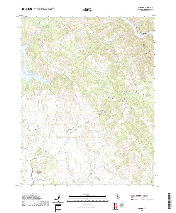
2021 Map of Hornitos
USGS Topo · Published 2021About this map
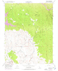
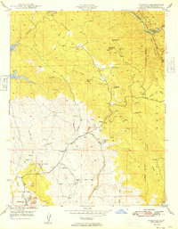
Hornitos and the neighboring settlement of Quartzburg anchor this modern topographic survey of the California foothills. The map documents a landscape defined by its Gold Rush-era history, evidenced by the preservation of significant local landmarks like the Hornitos Odd Fellows Cem and Saint Catherine's Catholic Church Cem. These sites, along with the Quartzburg Cem to the north, offer a direct link to the early pioneers of Mariposa County. The terrain transitions from the edges of Lake McClure and the Cotton Arm in the west through the high elevations of Williams Peak and Juniper Ridge. Notable drainages such as Hunter Valley and Hell Hollow carve through the landscape, while numerous seasonal watercourses like Eldorado Creek and Hornitos Cr delineate the natural drainage patterns that once supported the region's mining and ranching operations.
Find a feature on this map
41 named features on this map. Tap any name to fly to it.
Don’t see what you’re looking for? This feature index may not catch every label — zoom into the map to look around manually.
Map Details
Editions of this 2021 Hornitos Map
This is the sole edition of this map. No revisions or reprints were ever made.
Historical Maps of Mariposa County Through Time
3 maps found