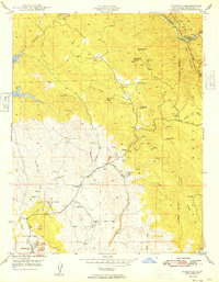
1949 Map of Hornitos
USGS Topo · Published 1949About this map
Hard-rock mining operations dominate this 1940s landscape in Mariposa County, following the gold-bearing veins through Hunter Valley and the surrounding foothills. The settlement of Hornitos serves as the focal point, situated near extensive Tailings and the historic Quartzburg Sch. The map reveals a complex industrial history through dozens of named shafts and prospects, including the Mt Gaines Mine, Morning Star Mine, and the Orange Blossom Mine north of Cotton Creek.
Find a feature on this map
35 named features on this map. Tap any name to fly to it.
Don’t see what you’re looking for? This feature index may not catch every label — zoom into the map to look around manually.
Map Details
Editions of this 1949 Hornitos Map
This is the sole edition of this map. No revisions or reprints were ever made.
Other maps of this area

1893 · Sonora
USGS Topo · 1:125,000

1896 · Sonora
USGS Topo · 1:125,000

1897 · Sonora
USGS Topo · 1:125,000

1898 · Sonora
USGS Topo · 1:125,000

1916 · Merced Falls
USGS Topo · 1:24,000

1919 · Indian Gulch
USGS Topo · 1:48,000

1919 · Haystack Mountain
USGS Topo · 1:31,680

1919 · Merced Falls
USGS Topo · 1:31,680

1920 · Indian Gulch
USGS Topo · 1:62,500

1944 · Merced Falls
USGS Topo · 1:62,500