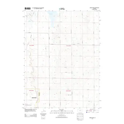
2013 Map of Horse Creek
USGS Topo · Published 2013About this map
Horse Creek Reservoir and the nearby Bootleg Reservoir anchor the northwest corner of this transition landscape where the eastern plains meet the growing infrastructure of the Front Range. The northeastern edge of Denver and the sprawling grounds of the Denver International Airport push into the Adams County border, showing the intersection of rural agriculture and modern transit. Water management is a central theme throughout the terrain, evidenced by the Denver-Hudson Canal and the natural drainages of Horse Cr, Box Elder Creek, and Lost Cr. These waterways cut through a regular grid of section roads like Imboden Rd and Manila Rd. A small aviation landmark, Greggs Nr 1 Airport, sits further east, highlighting the varied land use of this developing high plains corridor.
Find a feature on this map
44 named features on this map. Tap any name to fly to it.
Don’t see what you’re looking for? This feature index may not catch every label — zoom into the map to look around manually.
Map Details
Editions of this 2013 Horse Creek Map
This is the sole edition of this map. No revisions or reprints were ever made.
Other maps of this area

1890 · East Denver
USGS Topo · 1:125,000

1902 · Greeley
USGS Topo · 1:125,000

1942 · Mile High Lakes
USGS Topo · 1:31,680

1942 · Box Elder School
USGS Topo · 1:31,680

1949 · Sunnydale
USGS Topo · 1:24,000

1949 · Bennett
USGS Topo · 1:24,000

1949 · Hudson
USGS Topo · 1:24,000

1950 · Keenesburg
USGS Topo · 1:24,000

1950 · Prospect Valley
USGS Topo · 1:24,000

1951 · Keenesburg
USGS Topo · 1:24,000