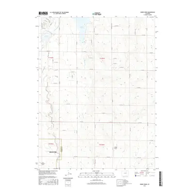
2016 Map of Horse Creek
USGS Topo · Published 2016About this map
Horse Cr Reservoir and Bootleg Reservoir anchor the northern landscape of this Adams County terrain, situated just north of the expanding footprint of Denver. The area serves as a critical hydrological intersection where the Denver-Hudson Canal cuts across the drainage of Box Elder Cr and Horse Creek. This 2016 survey captures a transitional zone between rural ranch land and the massive infrastructure of the Denver International Airport, which occupies the southwestern corner of the sheet. The map reveals a grid of rural routes like Cavanaugh Rd and Quail Run Rd that delineate the agricultural sections, while smaller landing strips like Greggs Number 1 Airport highlight the region's aviation character. This documentation of the high plains drainage, including Lost Cr, provides a detailed look at the complex water management systems essential to the outskirts of the Colorado capital.
Find a feature on this map
53 named features on this map. Tap any name to fly to it.
Don’t see what you’re looking for? This feature index may not catch every label — zoom into the map to look around manually.
Map Details
Editions of this 2016 Horse Creek Map
This is the sole edition of this map. No revisions or reprints were ever made.
Other maps of this area

1890 · East Denver
USGS Topo · 1:125,000

1902 · Greeley
USGS Topo · 1:125,000

1942 · Mile High Lakes
USGS Topo · 1:31,680

1942 · Box Elder School
USGS Topo · 1:31,680

1949 · Sunnydale
USGS Topo · 1:24,000

1949 · Bennett
USGS Topo · 1:24,000

1949 · Hudson
USGS Topo · 1:24,000

1950 · Keenesburg
USGS Topo · 1:24,000

1950 · Prospect Valley
USGS Topo · 1:24,000

1951 · Keenesburg
USGS Topo · 1:24,000