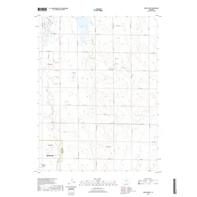
2019 Map of Horse Creek
USGS Topo · Published 2019About this map
Denver’s northeastern suburban expansion meets the agricultural plains of Adams County in this 2019 survey. The landscape is defined by the transition from the city's modern infrastructure, including the northern edge of Denver International Airport, to the open drainage basins of Horse Creek and Box Elder Creek. Essential water management for the region is evidenced by the Horse Creek Reservoir and the Denver-Hudson Canal, which divert resources across this semi-arid terrain. The grid-based road network, featuring routes such as Quail Run Road and Cavanaugh Mile Road, highlights the organized parceling of land that characterizes the area's development. Small-scale water features like Bootleg Reservoir and Lost Creek punctuate the vast intervals between arterial roads, illustrating the localized drainage patterns that influenced early homesteading and modern municipal planning at the edge of the metro area.
Find a feature on this map
50 named features on this map. Tap any name to fly to it.
Don’t see what you’re looking for? This feature index may not catch every label — zoom into the map to look around manually.
Map Details
Editions of this 2019 Horse Creek Map
This is the sole edition of this map. No revisions or reprints were ever made.
Other maps of this area

1890 · East Denver
USGS Topo · 1:125,000

1902 · Greeley
USGS Topo · 1:125,000

1942 · Mile High Lakes
USGS Topo · 1:31,680

1942 · Box Elder School
USGS Topo · 1:31,680

1949 · Sunnydale
USGS Topo · 1:24,000

1949 · Bennett
USGS Topo · 1:24,000

1949 · Hudson
USGS Topo · 1:24,000

1950 · Keenesburg
USGS Topo · 1:24,000

1950 · Prospect Valley
USGS Topo · 1:24,000

1951 · Keenesburg
USGS Topo · 1:24,000