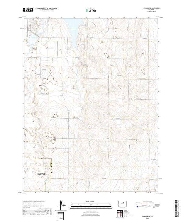
2022 Map of Horse Creek
USGS Topo · Published 2022About this map
Horse Creek Reservoir and the Denver-Hudson Canal anchor this agricultural and transit corridor on the edge of the High Plains. The landscape reflects the expansion of the Denver metropolitan footprint, most notably through the northeast reach of Denver International Airport where it crosses the Denver Co Adams Co boundary. Water management is a central theme, as the seasonal paths of Horse Cr, Box Elder Cr, and Lost Cr are supplemented by man-made storage like Boot Lake Reservoir. The grid of section roads, including Hudson Mile Rd and Cavanaugh Rd, underscores the transition from traditional farming tracts to industrial and aviation infrastructure at the state's primary transportation hub.
Find a feature on this map
50 named features on this map. Tap any name to fly to it.
Don’t see what you’re looking for? This feature index may not catch every label — zoom into the map to look around manually.
Map Details
Editions of this 2022 Horse Creek Map
This is the sole edition of this map. No revisions or reprints were ever made.
Other maps of this area

1890 · East Denver
USGS Topo · 1:125,000

1902 · Greeley
USGS Topo · 1:125,000

1942 · Mile High Lakes
USGS Topo · 1:31,680

1942 · Box Elder School
USGS Topo · 1:31,680

1949 · Sunnydale
USGS Topo · 1:24,000

1949 · Bennett
USGS Topo · 1:24,000

1949 · Hudson
USGS Topo · 1:24,000

1950 · Keenesburg
USGS Topo · 1:24,000

1950 · Prospect Valley
USGS Topo · 1:24,000

1951 · Keenesburg
USGS Topo · 1:24,000