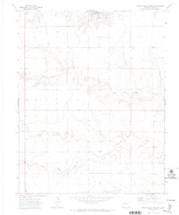
1971 Map of Horse Creek Springs
USGS Topo · Published 1973About this map
Horse Creek Springs serves as a focal point in this 1970s landscape of eastern Colorado, where the water systems of Baca County dictate the patterns of human activity. The map reveals an intricate network of drainage, including the converging branches of North Horse Creek, South Horse Creek, and the primary Horse Creek channel. To the north, the presence of the Two Buttes Reservoir signifies a concerted effort to manage water in this arid region. The terrain is marked by numerous Wells, indicating the reliance on groundwater for agricultural and livestock needs. Evidence of localized industry is found at a Gravel Pit, while a solitary Pen and various fence lines suggest the grazing history of the high plains during this era.
Find a feature on this map
10 named features on this map. Tap any name to fly to it.
Don’t see what you’re looking for? This feature index may not catch every label — zoom into the map to look around manually.
Map Details
Editions of this 1971 Horse Creek Springs Map
This is the sole edition of this map. No revisions or reprints were ever made.
Other maps of this area

1891 · Albany
USGS Topo · 1:125,000

1891 · Springfield
USGS Topo · 1:125,000

1892 · Vilas
USGS Topo · 1:125,000

1892 · Two Butte
USGS Topo · 1:125,000

1893 · Two Butte
USGS Topo · 1:125,000

1893 · Springfield
USGS Topo · 1:125,000

1893 · Albany
USGS Topo · 1:125,000

1955 · La Junta
USGS Topo · 1:250,000

1958 · La Junta
USGS Topo · 1:250,000

1968 · La Junta
USGS Topo · 1:250,000