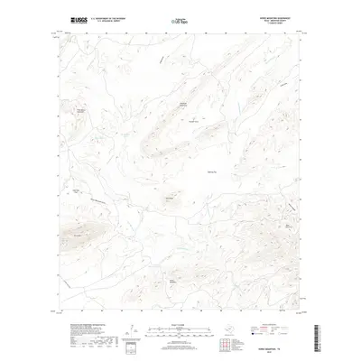
2019 Map of Horse Mountain
USGS Topo · Published 2019About this map
The Peña Blanca Mountains and Haymond Mountains dominate this Brewster County landscape, where water and topography are inextricably linked. The drainage patterns of Peña Blanca Cr and San Francisco Cr define the movement through this high desert terrain, carving out notable landmarks like Granger Cove and Water Canyon. The presence of Steel Tank and the uniquely named Dead Horse Hole and Dead Cow Hole speak to the vital importance of water sources for ranching and survival in the Trans-Pecos region.
Find a feature on this map
20 named features on this map. Tap any name to fly to it.
Don’t see what you’re looking for? This feature index may not catch every label — zoom into the map to look around manually.
Map Details
Editions of this 2019 Horse Mountain Map
This is the sole edition of this map. No revisions or reprints were ever made.
Other maps of this area

1917 · Hood Spring
USGS Topo · 1:62,500

1918 · Bone Spring
USGS Topo · 1:125,000

1918 · Hood Spring
USGS Topo · 1:62,500

1918 · Dove Mountain
USGS Topo · 1:62,500

1920 · Longfellow
USGS Topo · 1:125,000

1920 · Marathon
USGS Topo · 1:62,500

1921 · Marathon
USGS Topo · 1:62,500

1931 · Hood Spring
USGS Topo · 1:62,500

1954 · Fort Stockton
USGS Topo · 1:250,000

1958 · Fort Stockton
USGS Topo · 1:250,000